States
-
Recent Posts
Meta
Archives
Twitter Updates
Tweets by takeahiketonyCO

One of my favorite places to explore in Colorado is South Park. It is a vast and often inhospitable landscape surrounded by mountains on all sides, filled with wildlife and unique topography. A “park” is essentially a high mountain Valley, and South Park sits in the middle of the state. It is primarily a ranching community dotted with a few small hardscrabble towns like Jefferson, Fairplay and Hartsel.
To enter from any direction, you have to go over a mountain pass to what seems like a high-altitude bowl. Despite it’s reasonable proximity to Denver and Colorado Springs, the harsh winters and windy conditions even on the most beautiful summer days discourage too much resort or vacation development, although cabins and country homes dot the landscape. To get a taste of South Park in an easy day trip from Denver, I often use this route:
Starting in the Denver metro area, take Route 285 southwest from the city up through the foothill towns of Conifer and Bailey. As you come into the small town of Grant, keep an eye out for big horn sheep along the roadside and up into the rocky outcrops. The Shaggy Sheep café near Grant is a good place to stop for breakfast.
Continue past Grant on 285 up to the top of Kenosha Pass. Moose frequent the boggy areas near the top. The Colorado Trail crosses the highway at the top of the pass and offers nice hiking in either direction. A mile-long walk along the trail as it goes north (on the right-hand side of the highway) leads to a terrific overlook of South Park. In mid-September at peak foliage, this place can be a zoo but the golden aspen leaves put on a show worth dealing with the crowds. Before the decent over Kenosha take advantage of the overlook parking lot on the left to get a sweeping view of the valley below.
Continue down the backside of Kenosha Pass into South Park. The highway cuts across a vast, expansive landscape of irrigated cattle ranches and high sage brush meadows. Keep an eye out for pronghorn antelope, elk and coyotes. Black bear and mountain lions are also residents but remain more elusive.
As you come into the small town of Jefferson (visible from the top of Kenosha), make a left onto Route 77 / Tarryall Road. Follow this road along Tarryall Creek for about 16 miles to Tarryall Reservoir. The reservoir is a good place to check out birds including summer populations of white pelicans. Park at the South end of the reservoir and hike around the waterfall spill way, or hike the shoreline of the reservoir itself.
Continue South on 77 to the very small town of Tarryall, stopping along the way to check out the road-side signs and a few historic homesteads. In Tarryall, make a right onto County Road 31 (CR31), a dirt road that cuts across a maze of back roads and ATV trails.
CR31 will end at State Highway 24. Make a right onto Route 24 and follow up over Wilkerson Pass. Stop here to take in a sweeping view of southern South Park with the Collegiate Peaks and Eleven Mile Canyon Reservoir in the distance. A side trip to either Eleven Mile or nearby Spinney Mountain State Park give you additional chances to fish, see wildlife or hike along the water.
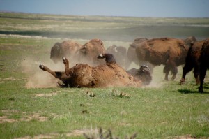
Continue on Route 24 over Wilkerson Pass toward the town of Hartsel, the geographic center of Colorado. Keep an eye out for herds of Antelope. Once in Hartsel, make a right onto Route 9 toward Fairplay. As soon as you turn onto Route 9 keep an eye out for a herd of Bison on the left. If they are around, there is a small state wildlife area pull off on the left that allows you a closer (and safely fenced) view.
Take Route 9 into the town of Fairplay, making a right back on to Highway 285. The town has a historic Mainstreet (take a left onto Route 9 in town). The town plays off of the South Park TV series with a few shops and signs, and also celebrates its mining history with a block of historic buildings and a visitor’s center.
For a scenic side trip, continue a few miles on Route 9 north through the town of Alma (highest incorporated town in North America) up to the top of Hoosier Pass. This is the top of the continental divide and offers great views and some very scenic hikes from the parking area.
Backtrack down Route 9 into Fairplay and make a left onto 285. For a great lunch or dinner, stop in at the very casual Mason’s High Country Barbeque. Take 285 back towards Jefferson and back over Kenosha Pass. At this point you will have completed a loop through the eastern half of South Park.
As you continue back up 285 toward Denver, Brooks Place Tavern and Madwell’s Italian Restaurant offer 2 good casual dinner options in Conifer.
 Kudos to the Southern Plains Land Trust in southeast Colorado for working to bring back native Bison to the prairie. Inspiring mission – and a good start with a few of these guys.
When I was traveling to the Denver / Boulder area for work, one of my favorite things was to be able to sneak in a scenic hike on the same day that I had to fly. You could either get in a morning walk with enough time to catch a mid-day flight, or even better, you could catch an early flight from the East Coast and be on a trail by 11 AM Mountain Time. I started to think of some of these trails as perfect “layover hikes”: Rocky Mountain Arsenal NWA, Walkers Ranch in Boulder, and this week I have to add North Table Mountain in Golden, CO to the list.
This is the perfect place to stop and stretch your legs after a flight into Denver before you head by car into the Mountains. In less than 2 hours, you can put in a few miles and take in some great scenery of the foothills and metro Denver. This flat topped Mesa dominates the Golden, CO skyline and has easy access to Route 70 if you are on your way to the ski resorts of Colorado.
On a recent afternoon, we hiked the North Table Loop Trail and passed a herd of wintering Elk and watched a lone Coyote chase down his lunch. The beautiful flat, grassy meadows at the top offer expansive views of the Plains to the East, the foothills to the West and a great view of the Denver skyline to the South. The trailhead is just north of the city of Golden on Route 93. Take a picnic to the top or build a little time to enjoy lunch on Washington Street in downtown Golden.
Being a new transplant to Colorado and having the sense of humor of a 14 year old boy, of course the first thing that comes to mind when I hear the words “South Park” are visions of Cartman, Kenny and all of the antics of the popular TV show. But in fact, the real South Park is quite a stunning landscape containing spectacular mountain views, vast grass lands, and some of the world’s best trout streams.
Geologically speaking, South Park is a grassland flat within the basin formed by the Rocky Mountains’ Mosquito and Park Mountain Ranges at approximately 10,000 ft in elevation within central Colorado. It encompasses approximately 1,000 square miles and is the largest and southernmost of three similarly named high altitude basins in the Front Range of Colorado, the others being North Park and Middle Park .
It is an easy drive from Denver – take Route 285 South towards FairPlay, and the road cuts through the center of the basin. Toward the South end, return on Route 24 towards Colorado Springs to get a different perspective from the South – plus a great view of Pikes Peak as you near I-25 for the return North towards Denver.
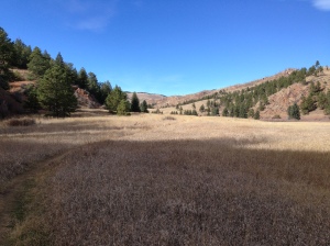
During a drive through the basin park today I caught more than a few spectacular views (and a few pronghorn antelope). I look forward to exploring some of the region’s fishing and hiking – but for now, these pictures have to do the talking:
To arrive too early in the marsh is an adventure in pure listening; the ear roams at will among the noises of the night, without let or hinderance from eye or hand. — Aldo Leopold, A Sand County Almanac.
I came across this line and my thoughts went immediately back to pre-dawn moments in the vast coastal marshes of southern New Jersey with Gabrielle during the World Series of Birding. More than even the forest, the sounds of a early morning marsh coming to life are like a symphony.
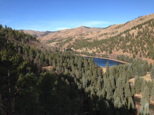
 About an hour west of Denver is another one of Jefferson County, Colorado’s terrific parks – Pine Valley Ranch. The park features beautiful trails into the foothills with mountain views, a gorgeous meadow walk, a lake and a flat hiking/biking trails that follows along the edge of the north fork of the south branch of the Platte River.
On my recent visit, I made the maximum loop by adding the steeper Park View & Buck Gulch trails with a loop around the meadow using the North Fork View trail and then back to the lower parking area on the Narrow Gauge Trail. All combined it is a comfortable 2 hour walk with great views.
If you work up an appetite, you are only a few minutes from the Bucksnort Saloon. It wasn’t open at the time I was there, but enough people had recommended the experience that it is worth the extra (very insanely narrow, perilous) mile of driving. 
 While flipping through an old copy of Bird Watcher’s digest, I stopped to enjoy this short essay by author and naturalist Julie Zickefoose:
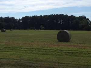
The hay roll, what a wondrous creation. Of all recent innovations in agriculture, it is my favorite. I say this not as a farmer, but merely one who appreciates the agricultural landscape. Hay rolls sit like Musk Oxen upon the newly mown meadows, tilting to one side and the other, sleeping, grazing, defining the meadow’s curve. Spaced just so, catching light, casting shadows, they make an ordinary hay meadow into an instant Stonehenge. Left for a season, hay rolls slowly deliquesce, weeping shed grass back onto the meadow, slumping, weathering to gray. A huge hairy hotel for voles, a hunting stop for foxes, a lookout for harriers, owls. So ancient do they look, evoking the haystacks in Monet’s paintings, that I always have to remind myself that the machinery to make hay rolls has been in use for only a few decades. It’s largely replaced the old square baler that spat out bound dominos of hay to be picked up by sweaty farmhands the same afternoon. I always groan when the hay rolls are finally gathered up and wrapped in white plastic, lined up obediently along the road to be loaded and used, no longer to grace the meadows of morning.